

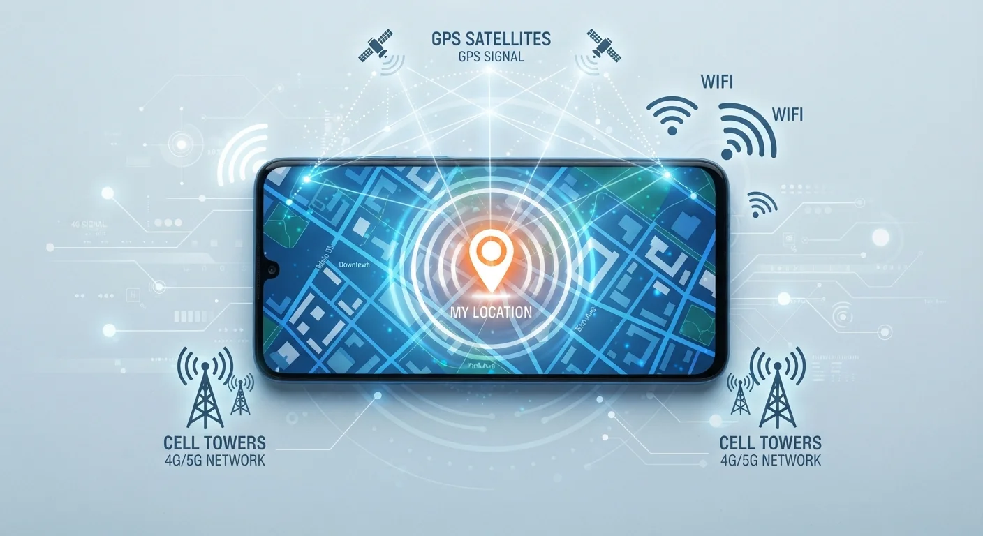
Three Systems Working Together
When you open a maps app and see a blue dot appear on your screen, it feels almost magical. But your phone isn't guessing — it's running three distinct location systems in parallel, then combining their results in real time.
Think of it like a team of witnesses each giving a slightly different vantage point on the same event. GPS satellites high above Earth provide the most precise measurement. Wi-Fi networks in your surroundings fill in the gaps when you're indoors. And cellular towers serve as a reliable fallback nearly everywhere you go. Your phone's location chip weighs all three inputs and produces a single, best-estimate position.
Understanding how each system works helps explain why your location is spot-on in an open parking lot, fuzzy in a shopping mall, and nearly instant even before GPS has fully locked on. For a broader look at the hardware powering all of this, see what all those phone specs actually mean.
24+
GPS satellites orbiting Earth
The U.S. GPS constellation is maintained with at least 24 operational satellites at all times, according to the U.S. Space Force.
~16 ft
Typical GPS accuracy for civilian phones
Under open sky, modern smartphone GPS is generally accurate to within 3–5 meters, per published GPS.gov documentation.
50–100 ft
Typical Wi-Fi positioning accuracy
Wi-Fi-based location estimates vary by router density and database quality, with urban areas generally achieving better results.
GPS: The Satellite Layer
The Global Positioning System is a network of at least 24 satellites maintained by the U.S. government, orbiting roughly 12,500 miles above Earth. Each satellite continuously broadcasts a time-stamped radio signal. Your phone's GPS chip receives signals from multiple satellites simultaneously and calculates how long each signal took to arrive.
Because radio signals travel at the speed of light, even tiny differences in arrival time translate into measurable distances. When your phone can "see" four or more satellites, it can calculate your latitude, longitude, and even altitude through a process called trilateration — essentially using overlapping spheres of distance measurements to pinpoint a single location in space.
The limitation: GPS signals are weak and struggle to penetrate buildings, dense tree cover, or urban canyons between tall skyscrapers. That's why GPS alone isn't enough for an always-reliable experience.
Speed Up Your GPS Lock
If your GPS feels slow to find your location, make sure your phone has an internet connection when you first open a maps app. This allows it to download Assisted GPS (A-GPS) data — a small file of satellite position predictions that helps your phone find satellites in seconds rather than minutes.
Wi-Fi Positioning: Your Router as a Landmark
Here's something that surprises many people: your phone can use Wi-Fi networks to figure out where you are without connecting to them. When your phone scans for available Wi-Fi networks, it sees each router's unique identifier — called a MAC address. Companies like Google and Apple have spent years driving vehicles and collecting data on the physical locations of millions of routers worldwide.
When your phone detects several nearby routers and cross-references their MAC addresses against this crowdsourced database, it can estimate your position — often to within 50–100 feet. This is why your location can snap into place almost instantly when you open a maps app, even before GPS satellites have been acquired.
Wi-Fi positioning works best in dense urban areas where routers are plentiful and well-mapped. It's also the primary method your phone uses indoors, where GPS signals rarely reach. To understand more about how Wi-Fi signals behave, our guide on how your home Wi-Fi network works explains the fundamentals clearly.
Cell Tower Triangulation: The Wide-Area Backup
Every cell tower your phone communicates with knows its own precise location. Your phone constantly measures the signal strength from surrounding towers — and in many cases, the timing of those signals — to estimate how far away each tower is. With readings from three or more towers, your phone can triangulate a rough position.
"Rough" is the key word. In a city with towers every few blocks, this method might get you within a few hundred feet. In a rural area with towers miles apart, accuracy can drop to a mile or more. Cell tower data is mainly used when GPS hasn't locked on yet or Wi-Fi positioning isn't available — it's the fallback that ensures location services keep working even in remote areas.
It's worth noting that this constant tower communication is also what makes cellular location a privacy consideration. Your carrier always knows which towers your phone is connected to, which means a general sense of your location is always known to the network — independent of any app permissions you've set. For more on how your phone's data connections work, see Wi-Fi vs. mobile data.
Location Permissions Control Apps, Not Signals
Denying location permission to an app prevents that app from reading your coordinates — but it doesn't stop your phone from receiving GPS signals or communicating with towers. Those processes happen at the hardware and network level regardless of app permissions. Managing permissions is still important for privacy, but it works differently than most people assume.
Frequently Asked Questions
Yes. Your phone can still estimate your location using nearby Wi-Fi networks and cell towers even when GPS is disabled. The accuracy will be lower — potentially within a few hundred feet rather than a few feet — but it works.
The GPS chip in your phone must actively communicate with multiple satellites and process incoming signals, which consumes significant power. Apps that keep GPS running continuously in the background — like navigation or fitness trackers — are the main culprits for battery drain.
It depends. Airplane mode disables cellular and Wi-Fi radios, but many phones allow you to manually re-enable Wi-Fi or Bluetooth in airplane mode. GPS itself is receive-only — it doesn't broadcast — so some phones continue to use GPS even in airplane mode, though this varies by device and settings.
GPS under open sky can be accurate to within about 10–16 feet (3–5 meters). Wi-Fi positioning is typically accurate to within 50–100 feet. Cell tower triangulation can range from a few hundred feet to several miles depending on tower density.
Only if you've granted them background location permission. Both iOS and Android let you control this in your privacy settings, where you can restrict apps to only accessing location while in use — or deny access entirely.
Indoors, GPS signals are often too weak to reach your phone through the building. Your phone falls back to Wi-Fi positioning or cell towers, which are less precise. If nearby Wi-Fi routers haven't been accurately mapped in location databases, your estimated position can be off by a block or more.
The content on this site is for informational purposes only and is not a substitute for professional advice. Always consult a qualified professional for guidance specific to your situation.